


Japan
Activities in Japan Side
Making full use of our potential strengths in the scientific fields of geomorphologic mapping, monitoring landslide movement, utilization of meteorological data, and numerical analysis for slope failures, the Japanese team is going to develop of a simple method for landslide susceptibility mapping to reduce landslide disasters, in cooperation with researchers in other Asian countries as well. Major research items defined as three Work Packages (WP) in our collaborations are led by each principal researcher; Prof. Go Sato for WP1: Geomorphologic Mapping and Monitoring Landslide Movement, Dr. Takeshi Murata for WP2: Utilization of Meteorological Data, and Prof. Akihiko Wakai for WP3: Numerical Analysis for Slope Failures
(JSTのリンク)
Typical landslides sites treated as research targets in our collaborative works are briefly listed bellows:
Task 1: Geomorphologic Mapping
- We propose using “AW3D” satellite data from the Thailand and Vietnam sites. Data includes high-resolution digital elevation models (DEMs) generated from Japanese technology. At the Japan site, we use LiDAR data collected from airborne measurements. Both types of data have 1 m resolution. We will clarify the landslide distribution and characteristics from these data and detect landslide-prone areas using geomorphologic interpretation.
Task 2: Monitoring landslide movement
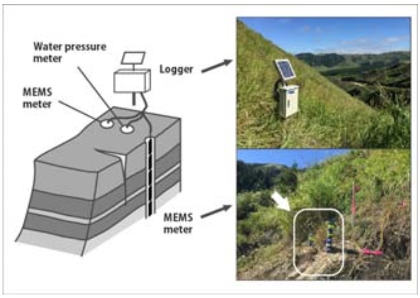
Fig. 1 Image of the monitoring system
- The inclinometer will be used in conjunction with an acceleration meter to measure movement. In our future work, our goal is to understand the relationship between landslide activity and rain infiltration at the field site. In addition, this system will be applied to developing an early warning system. On a trial basis, we have already started observations using this monitoring system in Japan (Fig. 1).
- Measuring landslide movement can be achieved with a monitoring system based on a wireless sensor network that transmits data to a server via a GSM gateway (Fig. 2). This system will be configured at
our test site in Thailand and Vietnam.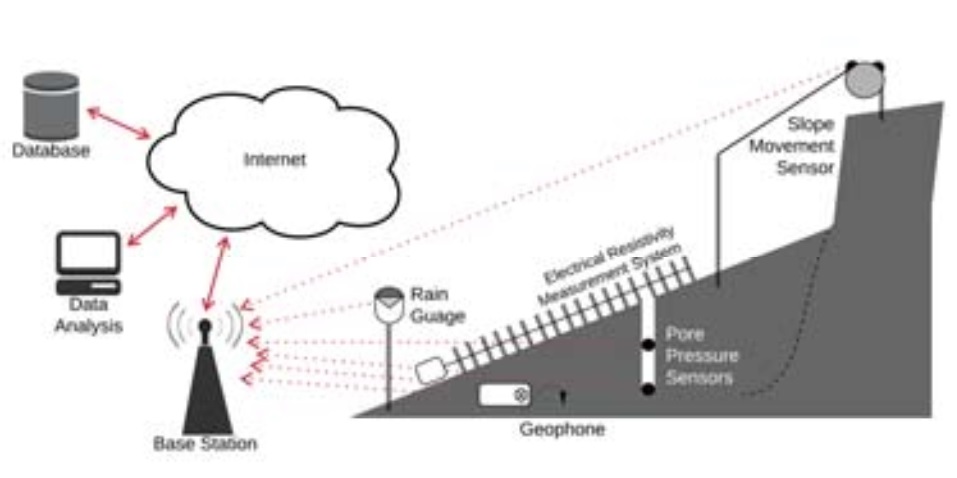
Fig. 2 Real-time monitoring system
Task 3: Developing a simple method for landslide susceptibility mapping
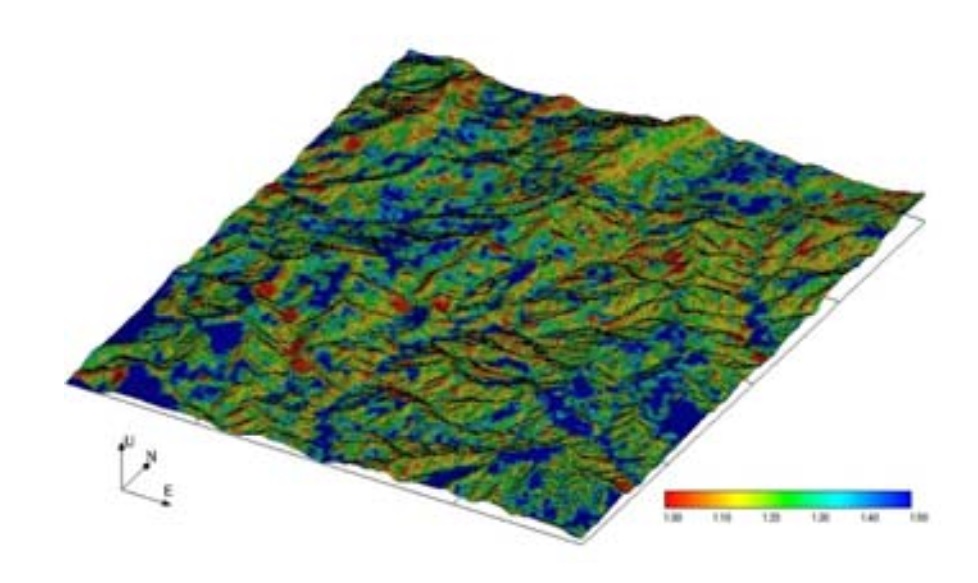
Fig. 3 Image of the landslide susceptibility
- Landslide susceptibility mapping based on the minimum factor of safety for each slope can be achieved using geologic, geomorphologic, rainfall intensity data for the targeted hilly area. In our future work, a simple method for predicting rising groundwater in slopes over time will be developed based on parametric studies with finite element analysis assuming a semi-infinite homogeneous slope. After integrating all the described engineering techniques, an effective method to develop landslide susceptibility mapping for each slope will be developed, as shown in Fig. 3.
The above sites are regarded as the places where the proposed method is tested or refined through experiences. The results of its validation will be reported on this website in the future.